DATE 1st January 2023
TIME 08:00
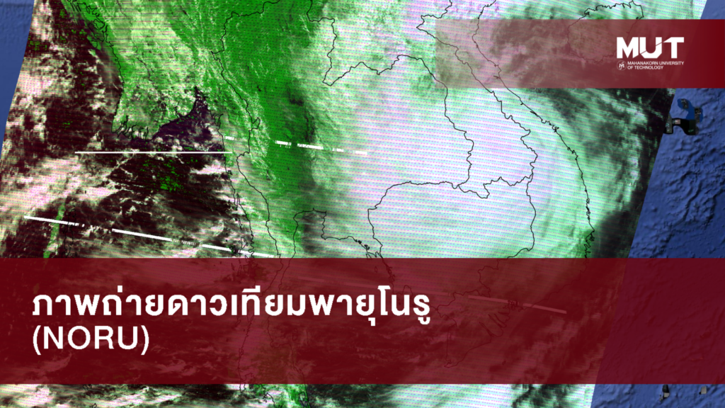
Mahanakorn University of Technology Thai Phat Satellite Research Center To track the path of the storm Noru (wish), which is travelling from Vietnam into Thailand as of the date 27 September 2022, satellite station Mahanakorn Institute of Technology captured a picture of the storm as it passed over the country from satellites Earth and Aqua.
Finally, a group of scientists from the Tai Phat Satellite Center MUT. Having captured still photographs of Storm Noru (wish) as it approached Thailand on September 28, 2022, between 7:00 and 17:40 (Thailand time), in order to create animation so that it may be viewed clearly. The shots from satellites in the aforementioned images are authentic.
Nonetheless, Mahanakorn University of Technology advises residents of dangerous locations to exercise caution and pay special attention to any weather-related alerts. Together, we will work through this.
Thanks for the satellite photo Thai Phat Satellite Research Center Mahanakorn University of Technology
Compiled satellite images by Asst. Prof. Dr. Supongsa Ketkhiri, lecturer of the Department of Physics Faculty of Science
Receiving satellite signals by Mr. Aniwat Safe, Thaipat Satellite Research Center Mahanakorn University of Technology